ISLAMIC, INDIAN ART & JEWELS
Lot 148:
Description
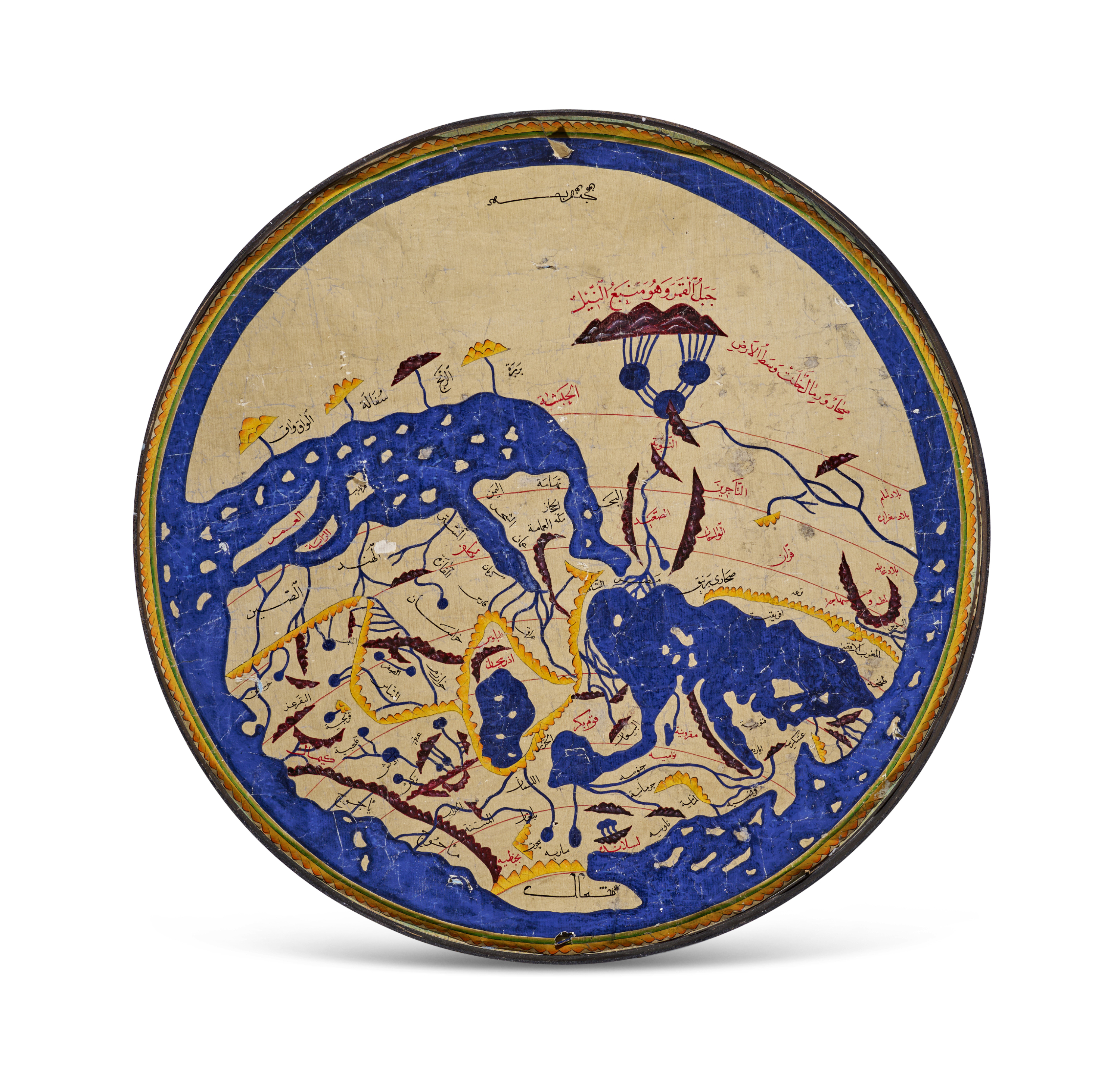
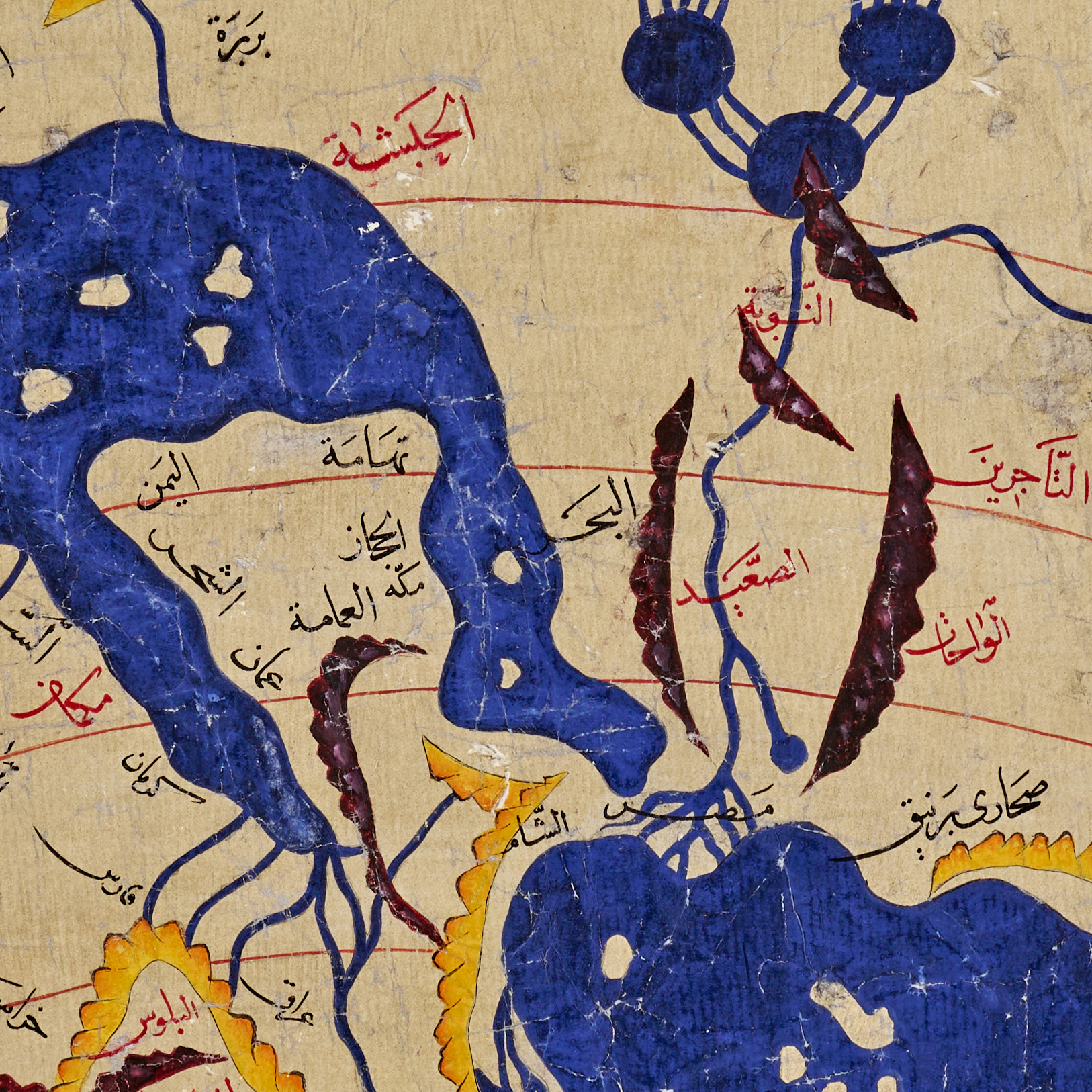
A vibrant and finely executed painted version of the famous medieval world map by the renowned Arab geographer al-Idrisi, produced in the 19th–20th century. Rendered in watercolour on paper, the circular map displays al-Idrisi’s characteristic geographical vision with south placed at the top, following the convention of early Islamic cartography.
The continents, seas, and mountain ranges are delineated in bold hues, with deep blue oceans contrasting against the pale ground. Place names, rivers, and mountain ranges are meticulously labelled in yellow, black, and red ink, echoing the visual language of classical Islamic manuscript maps. The composition reflects the style of the Nuzhat al-Mushtaq (“The Book of Pleasant Journeys into Faraway Lands”), one of the most important geographical works of the medieval world.
The map is enclosed within a circular border and shows expected signs of age and handling, which contribute to its distinctive character. A striking and historically resonant piece, it would appeal to collectors of Islamic cartography, manuscript art, and geographic history.
Diameter: 61 cm.
In the 12th century, scholar Al-Idrisi produced a map showing most of Europe, Asia, and North Africa for the first time. Al-Idrisi ranged widely, drawing on older knowledge and interviewing thousands of travelers to make his map the most accurate of its day. Muhammad ibn Muhammad al-Idrisi (circa 1100–66) was a 12th century geographer from al-Maghrib (North Africa). Born of noble lineage in Sabtah (the present-day Spanish enclave of Ceuta in Morocco), he studied in Cordoba. Al-Idrisi traveled extensively in the Mediterranean and Atlantic coastal regions, including North Africa, Spain, Anatolia, the northwestern coast of the Iberian Peninsula, and the coastline of France. Al-Idrisi gained the attention of Norman King Roger II (reigned 1130–54) of Sicily, who commissioned al-Idrisi to produce his masterpiece Nuzhat al-mushtaq fi ikhtiraq al-afaq, known as Tabula Rogeriana–the first descriptive geography of the world’s major population centers.
Share this lot: